Selection of Maps I contributed to during my Internship at WithersRavenel
I had the oppertunity to work as a community planning intern summer of 2025 where I was exposed to various planning related GIS maps.
Maps Ꮚ´ꈊ`Ꮚ
Draft Future Land Use map for Angier. I worked with the community planning team to create a parcel based future vision for the town.
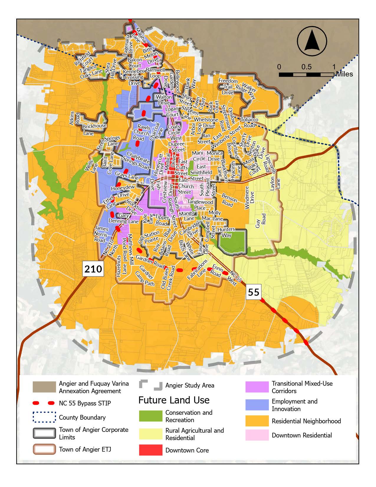
Projected land use determined through georeferencing approved developments and modifying polygons to represent new parcels and proposed uses.
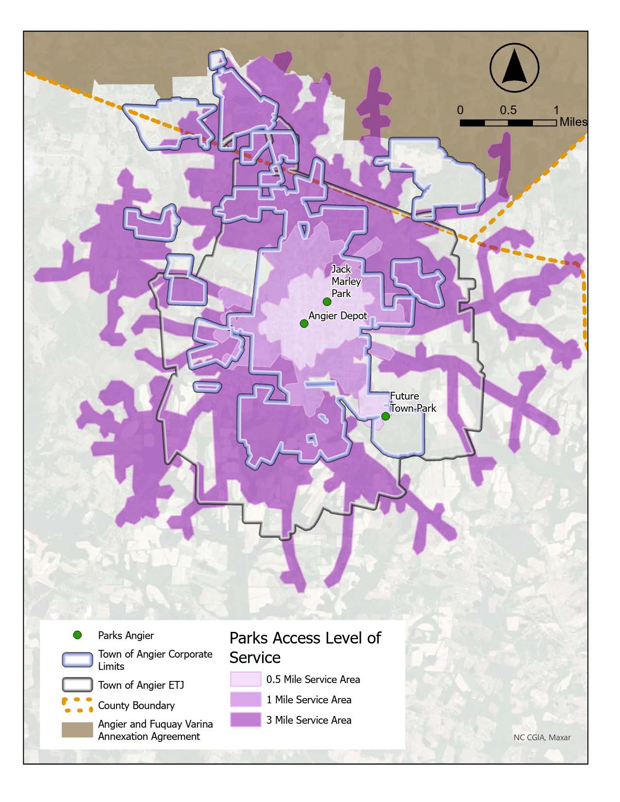
Drive Time Analysis of Parks created on ArcGIS Online