Choropleth or Proportional Symbol Map
In this map I chose not to include a north arrow or a scale bar because the values being displayed have nothing to do with direction or the size of the area. Beyond this because it is a map of the United States there is general knowledge as to the size in relation to other contries along with which way is north.
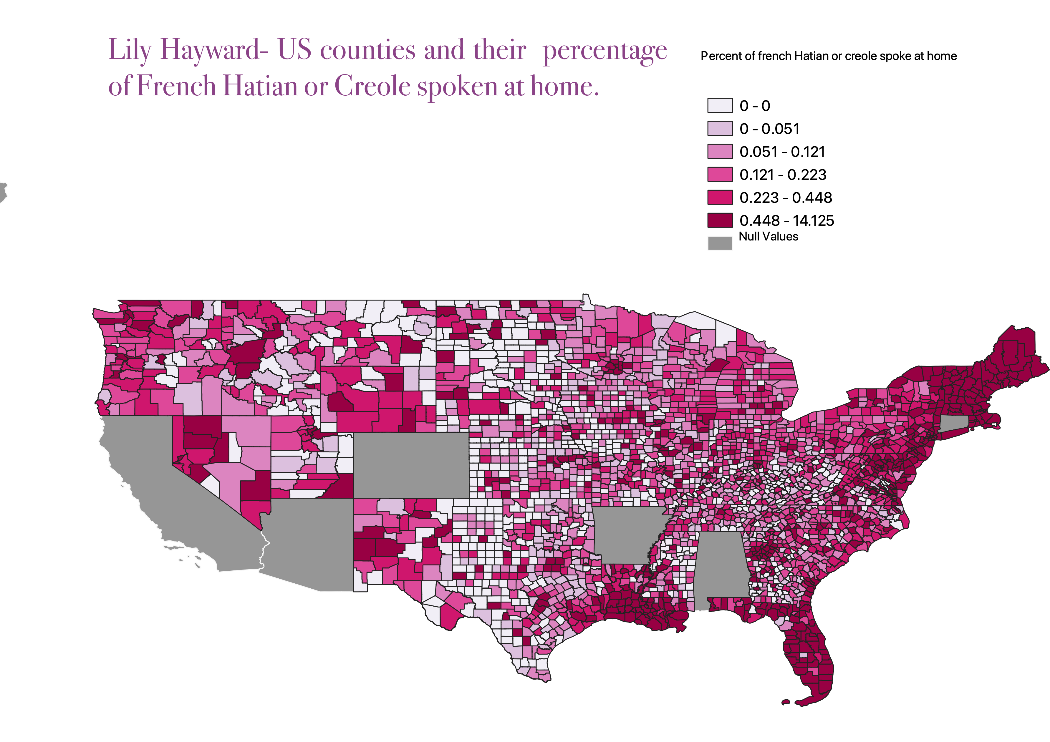
This displays an equal interval map of the percent of the counties that speak french, hatian, or creole at home. There are some states that had null values and didn't upload their data to the website in which I attained my info.
Data used in this project ٩(˘◡˘)۶
CSV stored on Git website.
I couldnt find a way to direct one to the exact link of where i got the data so this is the general website and I made it all avaliable counties in the US then with that I clicked on the language tab and from there I clicked on my topic of choice
Where I got the data
csv for download
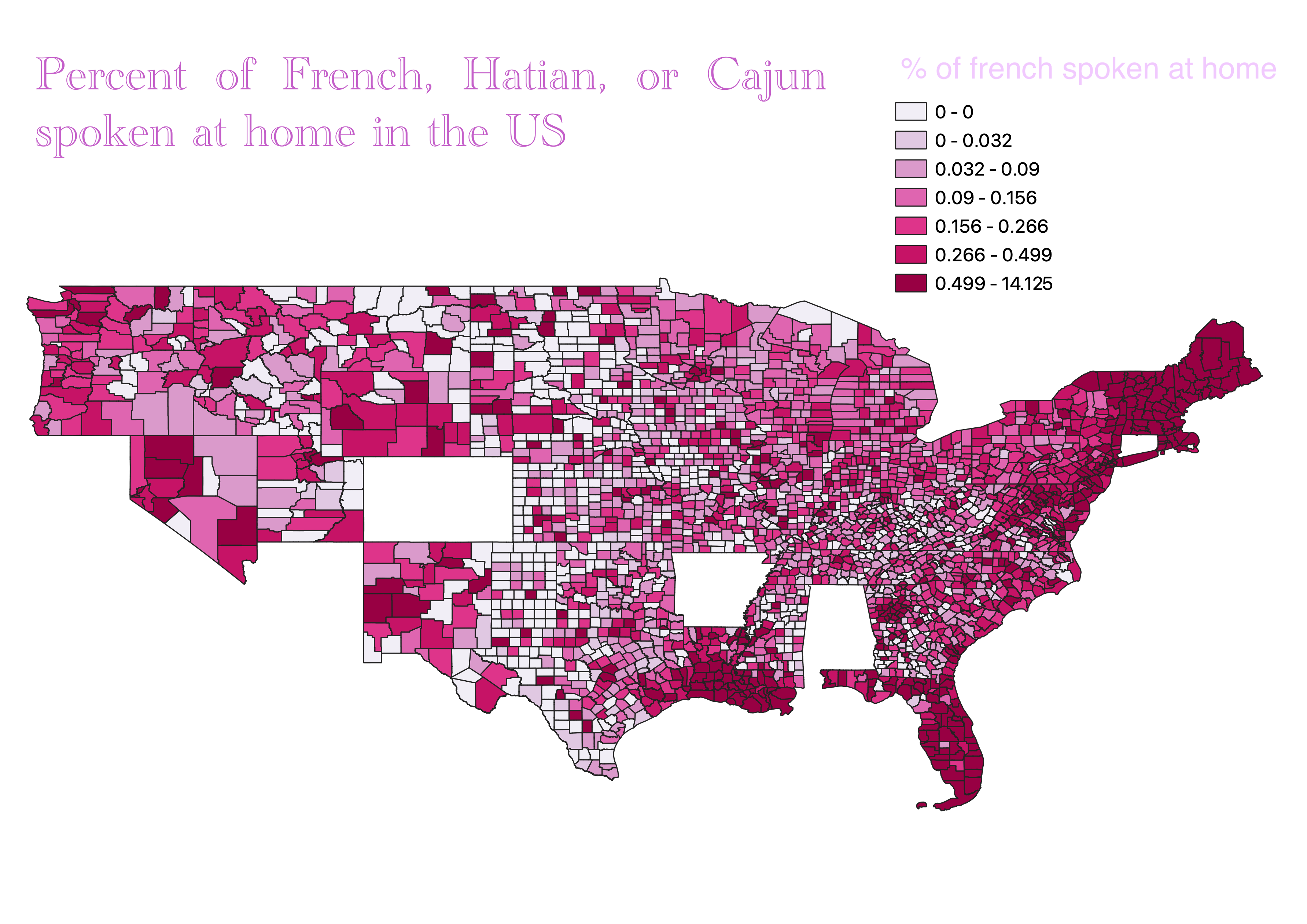
I saw a small error with how my map looked- I Completed this in class because I realized I had a different state shapefile that would look good under it. I just wanted to fix my error and show my post-turning in this homework process.